Parma School District Survey

ICRIS record 10CN532 · Parma, Idaho

Parma High School Campus

An evolved educational landscape joining academic buildings, district offices, vocational facilities, circulation systems, and a broad range of athletic resources.

1957 + later phases1105 East McConnellCanyon County40 survey views
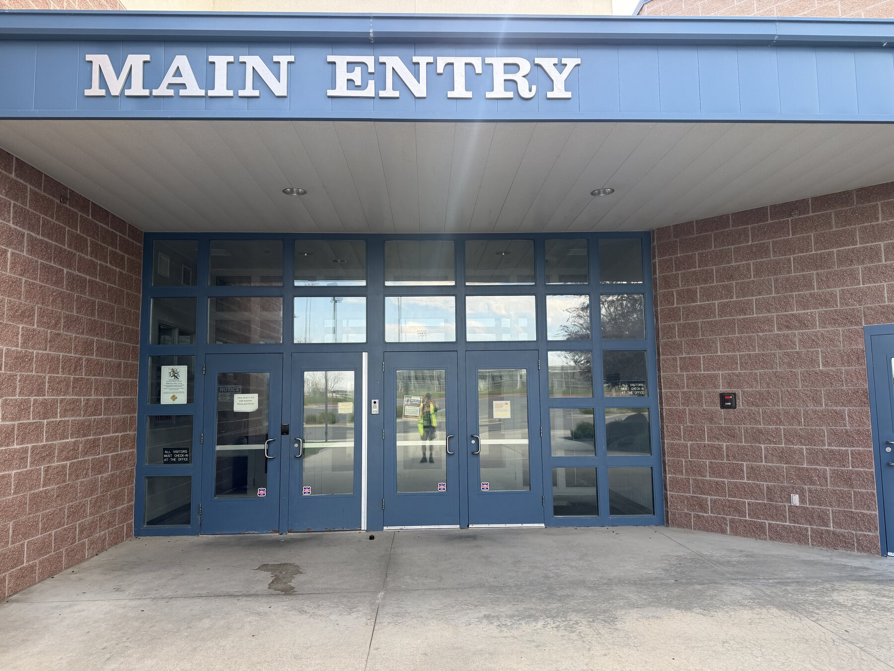
Parma High School principal entrance
Parma High School principal entrance and north elevation, showing the glazed entrance, blue metal fascia, brick walls, and public approach. View south.
01 · The record

A campus recorded as a system

The resource extends beyond one high-school building. Its academic, administrative, vocational, circulation, and athletic parts explain how the district campus works and how it has changed.

Smithsonian number
10CN532
IHSI number
27-14541
Historic name
Parma High School
Field ID
88-D-373
Property type
Evolved educational campus
Original use
Education · School
Construction
1957 + later phases
Eligibility
Unevaluated
Center coordinates
43°47.37′ N, 116°56.17′ W
Historic survey
1988 · Jim Koehler
Survey update
Forty current-condition photographs by Jeffery Holley, March 29, 2026. The package documents the district block east of North 8th Street without assigning contributing status or making an eligibility determination.

Architectural description

10CN532 occupies the block east of North 8th Street between East McConnell Avenue and Walker Road. Academic buildings fill the southern part of the block; athletic grounds extend north. Panther Way, parking areas, drives, walks, lawns, fenced courts, and field routes connect the campus.

Parma High School is chiefly one story, with an irregular plan assembled from low classroom, commons, service, and assembly volumes. Reddish brick, textured concrete masonry, blue metal fascias, shallow roofs, grouped windows, glass block, broad canopies, and glazed entrances define its exterior.

The Bruce Mitchell Science and Technology Center uses stepped brick volumes and a taller name-bearing masonry block. Panther Library and Parma Middle School form low wings around walks, lawns, and courtyards. Julian Laca Gymnasium rises above them as a tall brick volume with a shallow curved roof.

The district office, AG/VO building, and greenhouse add administrative and vocational functions. North of the schools, the tennis courts, baseball complex, football stadium, athletic entrance, concession stand, storage trailer, fences, lighting, and fields complete the campus landscape.
Character-defining features

  • Integrated academic and athletic campus
  • South-to-north organization of buildings and fields
  • Multiple construction phases
  • Low brick and concrete-masonry academic wings
  • Blue metal fascias and entrance canopies
  • Grouped windows and glass-block panels
  • Covered passages, courtyards, and sheltered circulation
  • Julian Laca Gymnasium’s tall brick volume and curved roof
  • District office, AG/VO building, and greenhouse
  • Jessie Eddie Tennis Courts
  • Bob Sloan Baseball facilities
  • Football field, track, grandstand, and press box
  • Panther Athletic Entrance
  • Concrete-block concession stand
  • Network of roads, walks, lawns, fences, and fields
02 · Campus significance

Education extends beyond the classroom

The campus records a broad civic investment in education: classrooms, science, vocational training, administration, libraries, athletics, gathering spaces, and the routes that bind them together. Its value lies in the relationships among those parts as much as in any single building.
The current ICRIS record lists overall and individual eligibility as unevaluated. This documentation identifies visible evidence and present conditions; it does not make a National Register determination.
03 · Photo survey

Forty views across the campus

The sequence begins with the high school, moves through the science center, library, middle school, gymnasium, district and vocational buildings, then crosses the athletic grounds. Select any photograph to expand it.

04 · Photo key

Camera stations and campus coverage

The three-sheet key locates the documented resource area and the numbered camera stations used for the academic campus and athletic grounds.